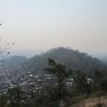
Al Cerro de Zacatenco no se le puede hacer justicia en un par de párrafos. Situado en el codo interior de la Gustavo A. Madero en forma de L, es un lugar mítico. Rodeado de antiguos hallazgos y descubrimientos arqueológicos, es probable que aún guarde varios secretos.
El extremo noreste del cerro se encuentra en San Juan Ixhuatepec, en Tlalnepantla, Estado de México. La zona está densamente poblada en prácticamente todos sus lados. Y, como el resto de la Sierra de Guadalupe, forma parte del extremo norte de la Ciudad de México. Hacia el sur, la montaña da paso poco a poco al Cerro de Tepeyac y al parque nacional, con Santa Isabel Tola al este.
Toda la Sierra de Guadalupe forma parte del Eje Neovolcánico. Eso explica la presencia no sólo de los cruces de montañas, sino de estos pequeños volcanes monogenéticos. Muchos de ellos se levantan en la propia Ciudad de México, y a lo largo del Eje Volcánico Transversal de México, que atraviesa el centro del país de costa a costa.
El nombre náhuatl se traduce como “borde de la hierba”, refiriéndose especialmente a los pastos forrajeros que aún crecen aquí. Hoy en día, el nombre se presta a la ciudad de San Pedro Zacatenco, pero aún más, al gigantesco campus de la Universidad Politécnica Nacional, que lo toma prestado. Se le suele llamar simplemente “Zacatenco” para distinguir este campus del original en el Casco de Santo Tomás, cerca del Metro Normal. De hecho, desde la Línea 1 del Cablebús, el Cerro de Zacatenco y el campus son prácticamente las vistas más espectaculares entre la primera y la segunda estación.
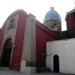
Cercano a 0.74 kms.
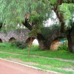
Cercano a 0.82 kms.

Cercano a 0.93 kms.
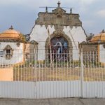
Un templo dedicado a la primera santa indígena de América . . .
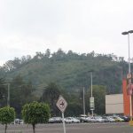
Una punta de la Sierra de Guadalupe confundida frecuentemente...
Entre los picos del sur de la reconocida Sierra de Guadalupe...

La estación de Cablebús Ticomán es solo la primera parada en tu camino hacia el norte de la Ciudad de México.

Tu primera parada en la aventura del Cablebús del norte...