El volcán Xaltepec es uno de los picos más conocidos y el tercero más alto de la Sierra de Santa Catarina. Es uno de los más llamativos, situado a unos 2 567 metros sobre el nivel del mar. La mayor parte de la cadena montañosa corre a lo largo de la frontera con Iztapalapa y este volcán está casi en su totalidad en Tláhuac.
A veces denominado “Cerro de la Cruz”, es una figura especialmente importante para los residentes de la localidad de Santiago Zapotitlán que fue fundada en 1435. Sin embargo, hay escasa evidencia de viviendas incluso antes de las erupciones del volcán Xitle entre 245-315 e. C.
El nombre náhuatl se puede traducir de xalli, “arena” y tepec, una forma abreviada de la palabra tepetl, que significa “cerro”, aunque en realidad es mucho más que un “cerro de arena”.
La montaña ha sufrido una seria degradación por muchos años de extracción de tezontle, basalto y arena, pero esto no es nada nuevo. Científicos de la UNAM determinaron que aquí se extrajeron partes del Templo Mayor entre 1430 y 1500.
La ladera sur del volcán Xaltepec y la de Tetepec son particularmente amadas en Tláhuac. Estas fueron otorgadas como tierras de cultivo por los dominicanos en 1582. Aunque un gran deslizamiento de tierra ocurrió después de los terremotos de 2017, gran parte de la montaña está protegida actualmente. No solo es valioso para la vida silvestre, también es una fuente especialmente importante para la recolección de agua de lluvia que se filtra en las cuencas hidrográficas de la ciudad.
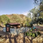
Cercano a 0.62 kms.
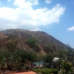
Cercano a 0.98 kms.

Cercano a 1.53 kms.

Un importante desarrollo recreativo en el DU Quetzalcóatl.

Uno de los parques urbanos más bellos de Iztapalapa . . .
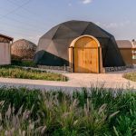
Iztapalapa's most sustainable and eco-conscious Utopia . . .
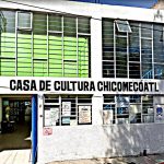
Chicomecóatl is a neighborhood center and cultural hub for communities in the shadow of the volcano.
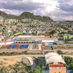
Un centro deportivo y cultural de temática acuática en la vertiente norte de la Sierra de Catarina.