>Residents of the city who’ve been here for any considerable time are very familiar with the image above.
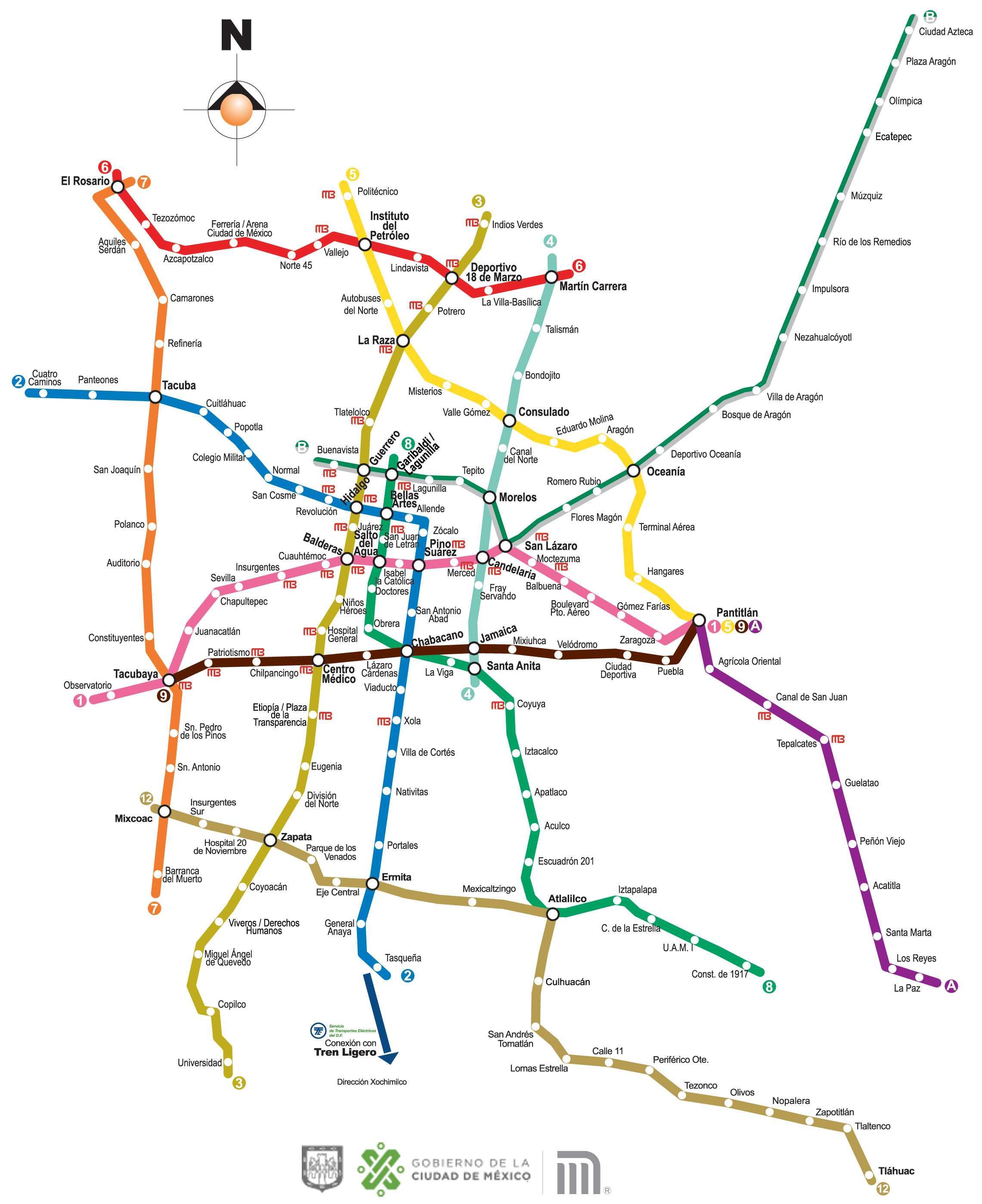
You might also like the version above which doesn’t make reference to surrounding streets, landmarks, or neighborhoods. It’s probably what most people think the Mexico City Metro map looks like, as we seldom realize we’re very often using it to make reference to the surrounding streets and neighborhoods.
“For me, the city was divided into Metro stations,
and I think that for those of us who use public transportation, it’s a shared experience.”– Eduardo Villegas, the Coordinador of the Historical and Cultural Memory of Mexico
Although more recently, more people will confirm exact locations on the Google Map below, the above has sufficed in its slightly more abstract version for decades.
The version above is also more familiar because it is displayed multiple times in every station of the Metro.
If you haven’t taken the Metro yet, you can check here for more information on how the system operates and what to expect.
There is also a much more comprehensive map of the integrated transport system for download from here.
And we’re building a station by station guide to the Mexico City Metro, here. As it takes shape, it’s only going to become more useful and more interesting.
If you have trouble finding your way with any of the maps or schedules, you can also call LOCATEL at any time of day or night.